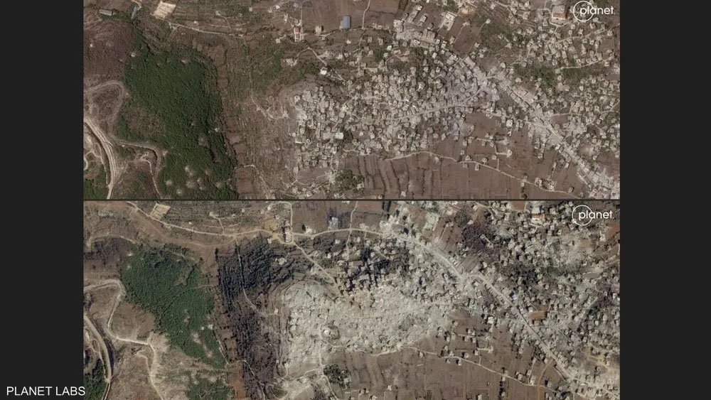
Recent satellite images have captured the extent of the devastation inflicted on two Lebanese villages, Mais al-Jabal and Aita al-Shaab, as a result of intense Israeli airstrikes along the Lebanon-Israel border. The images, released by satellite imaging company Planet Labs, reveal entire areas of the villages wiped out by the bombardments.
Earlier, Lebanon’s official National News Agency reported that 37 villages along the border had been severely impacted, with over 40,000 housing units destroyed in southern Lebanon. The devastation spans a three-kilometer strip from Naqoura to Khiyam. According to the agency, Israeli forces are “razing entire neighborhoods and demolishing buildings across numerous towns.”
The conflict between the Israeli military and Iran-backed Hezbollah has escalated significantly over the past six weeks, amid rising tensions related to the ongoing Gaza conflict. Israel has intensified airstrikes across Lebanon, with the Lebanese health authorities reporting more than 3,000 fatalities since late September.
The Lebanese Health Ministry confirmed that recent strikes on Tuesday killed five civilians near Baalbek, including two fatalities from an attack on a car. The rising toll and extensive destruction have drawn widespread concern over the humanitarian crisis emerging in southern Lebanon.


